
The term Geophysics refers to the examination of the Earth using physics so as to find out its properties which include gravity, size, atmosphere, weather, hot springs, volcanoes, oceans, lakes, ground water, movements etc. This is also referred to as seismology which is the process of studying seismic waves that shift through and around the earth from one location to another for example earthquakes.
The seismic technique is used so as to get a clear picture through observation of the earth’s subsurface basing on the standards of earth physics. When applied, shock waves set off at the surface of the earth go through it like sonar and when they are returning back, the echo they make is used to determine what is underneath the ground.
Petroleum geophysicists normally focus on the achievement, processing and understanding of seismic data.
Note: The whole process involves seismic data processing, seismic data interpretation and analysis, reservoir characterization and monitoring. We have skilled knowledgeable Geophysists who are ready to give you any services you need sine they are well informed about the Western East African Rift System.
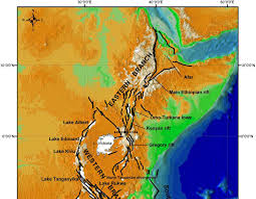
Map showing Western branch of East African Rift System
Petroleum geophysicists are divided into three various categories which include:
- Acquisition Geophysicists (these take photos of the subsurface just like X-Rays that show details of the human body). These often work for acquisition companies/ventures and allocate their time between office and field work spending weeks/time with field crews, field camps/ small villages. These also design and test initial instruments, write computer software for field computers/experiment using various ways of conducting the survey.
- Processing Geophysicists (develop and make the photos very clear). These generally apply computer programs to examine and amend the data constantly though; their biggest challenge is to know how programs influence the data to provide a perfect clear image of the earth. They also consult interpretation geophysicists about all available geological information including whether the images of the earth sharp/ clear enough and well focused.
- Interpretation Geophysicists (these apply the clear pictures/photos to build the shape of petroleum deposits). These also involve themselves in the field so as to detect all processes of data acquisition. They also clarify seismic data through applying all gathered geological information to determine a perfect picture if the earth using hasty, interactive work stations that are usually propelled onto vast screens.